Hurricane SANDY (27 October 2012) impacted the coast from North Carolina to northern New England. CSE’s project at Nags Head fared well (WRAL), but beaches in other parts of North Carolina’s Outer Banks (eg. Rodanthe), and many New Jersey and Long Island beaches experienced severe damage. The first breach inlets in many decades occurred along Fire Island (NY), site of previous CSE studies. While impacts of the storm are still being evaluated, we know from experience that coasts with healthy, wide beaches and high dunes generally can sustain most tidal surges with minimal damage. The profile absorbs the brunt of the storm. Beaches that are narrow and lack protective dunes tend to experience the greatest damages. Here are some post-SANDY photos from North Carolina that illustrate this.
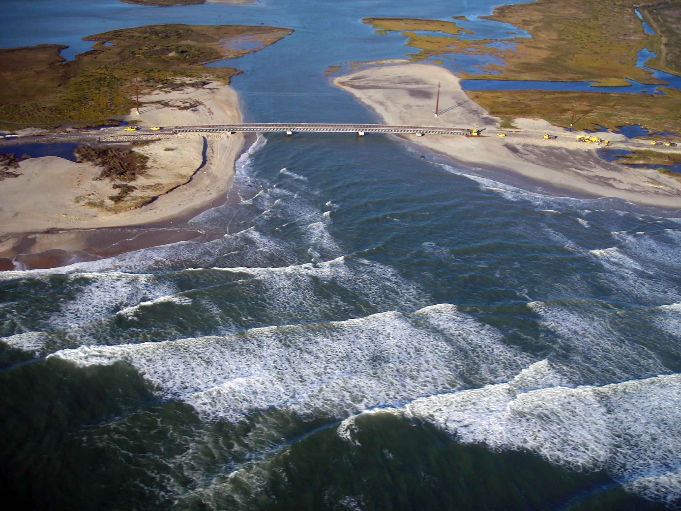
New Inlet, NC, which formed after passage of Hurricane Irene in 2011, following Hurricane Sandy.
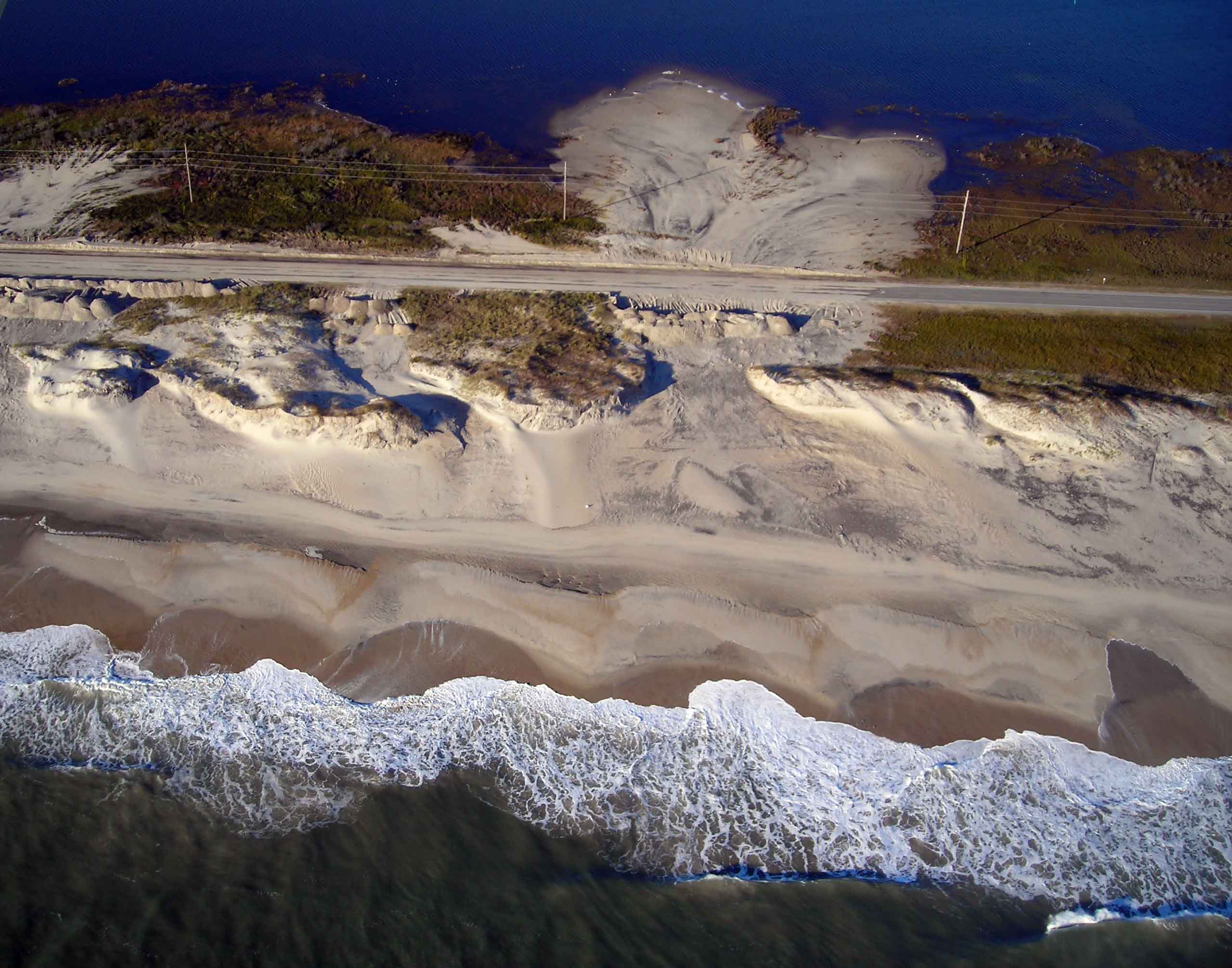
A washover on Pea Island, NC following Hurricane Sandy.
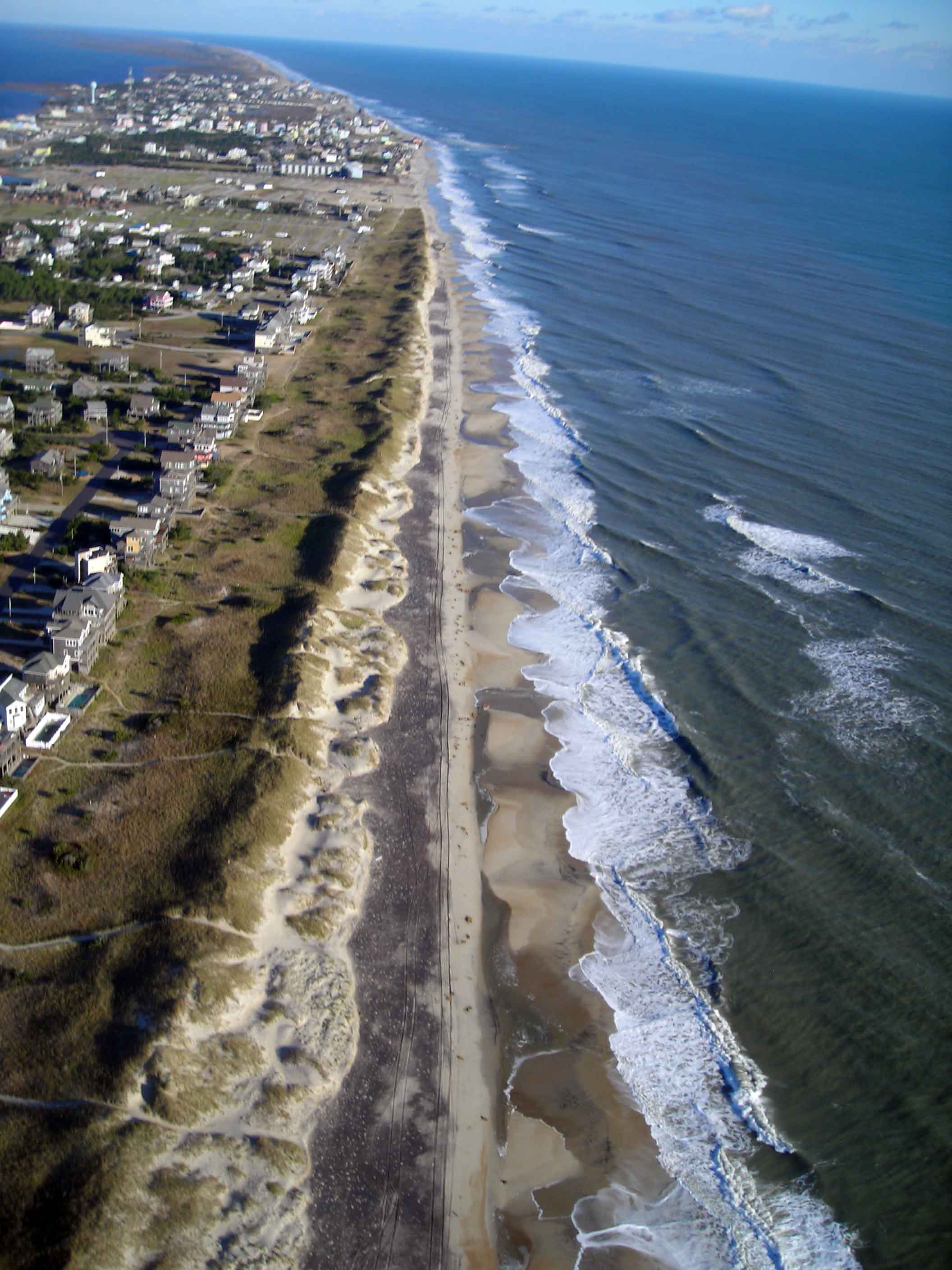
Salvo, NC downcoast of Rodanthe following Hurricane Sandy on 3 November 2012. Note high foredune and lack of washovers.
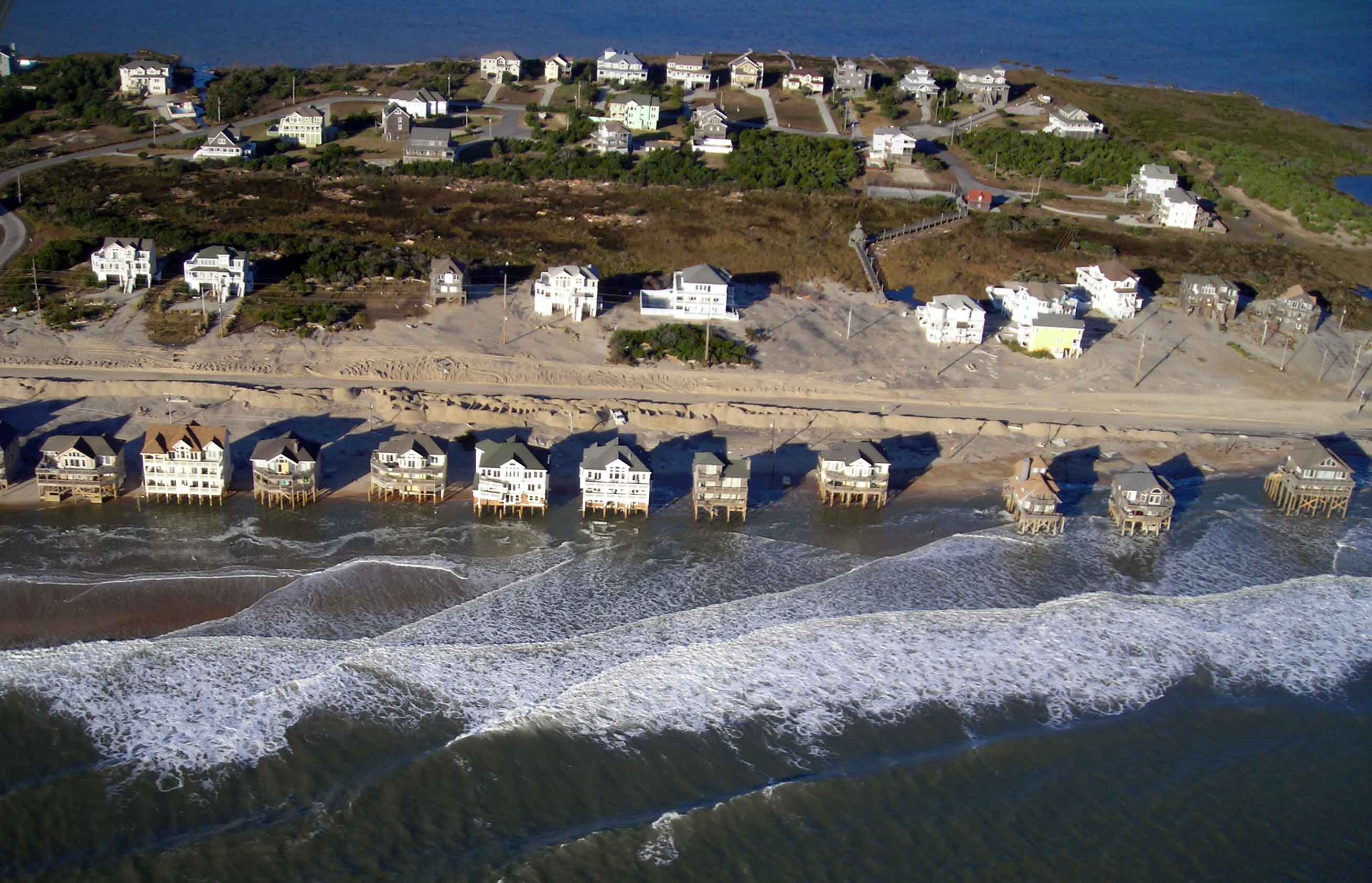
Rodanthe, NC following Hurricane Sandy. All images taken by Haiqing Kazckowski on 3 November 2012. Copyright CSE.
Potential breach points along barrier islands are predictable based on the condition of the profile—that is, how much sand is contained in the dune, beach and inshore zone. This can be easily determined through field measurements. CSE uses these fundamental measures to calculate sand deficits, recommend beach restoration quantities, and offer predictions of potential washover or inlet formation.
Following are some useful links and resources to learn more about breach inlet formation and management.
USACE Coastal Engineering Technical Note on Coastal Barrier Island Breaching (Part 1)
USACE Coastal Engineering Technical Note on Coastal Barrier Island Breaching (Part 2)
CSE prepared an analysis of potential flooding impacts along Great South Bay, Long Island for the New York Coastal Partnership, working in collaboration with Dr Lee Koppelman (former Supervisor of the Long Island Regional Planning Board). (CSE’s Executive Summary report).
New York has a Breach Contingency Plan prepared by the US Army Corps of Engineers, with input from the National Park Service and other federal and state resource agencies, which now provides a blueprint for managing the breaches caused by SANDY. (NPS FONSI Report for Long Island Breach Contingency Plan)
For an author’s copy of the related paper, Profile Volumes as a Measure of Erosion Vulnerability by TW Kana and RK Mohan 1996 Proc. Intl Conf Coastal Engineering, send a request to tkana@coastalscience.com.
Additional articles discussing Hurricane Sandy:
NY Times – Resisted for Blocking the View, Dunes Prove They Blunt Storms
American Shore & Beach Preservation Association – Assessing beach nourishment in the aftermath of Sandy (pdf)
American Shore & Beach Preservation Association – Link to additional articles
US Army Corps of Engineers – Hurricane Sandy efforts