
CSE maintains an extensive complement of field survey equipment for conducting measurements in support of our shoreline erosion assessments and beach nourishment plans.
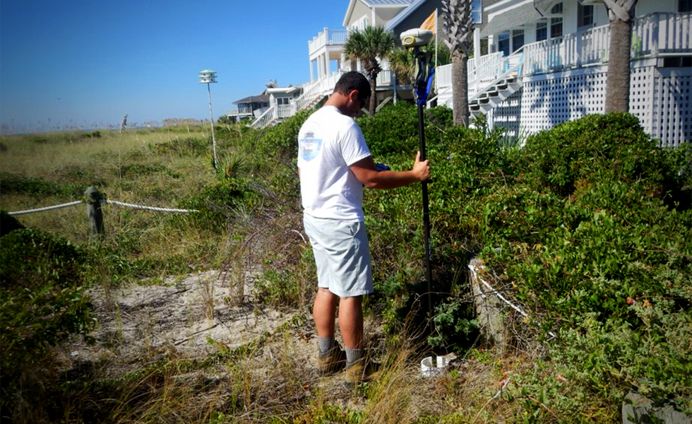
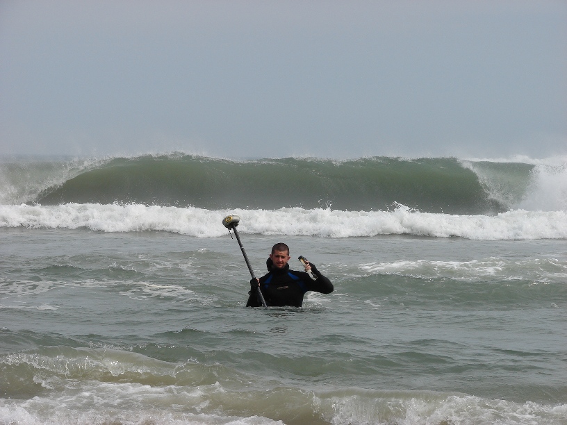
- Topographic and bathymetric surveying utilizing RTK-GNSS and RTN
- In Situ Wave, Tides, and Current Measurement and Analysis
- Sediment Transport Measurement and Analysis
- Topographic and Bathymetric Data Collection
- Beach Compaction Testing
- Sand Searches, Offshore and Inshore
- Advanced Sediment Grain Size Analysis
- Bottom Coring and Analysis
- Measurement of Water Quality Parameters
- Aquatic Resource Mapping and Database Development
- Beach Management Monitoring, Profiling, and Analysis
- GIS Database Development
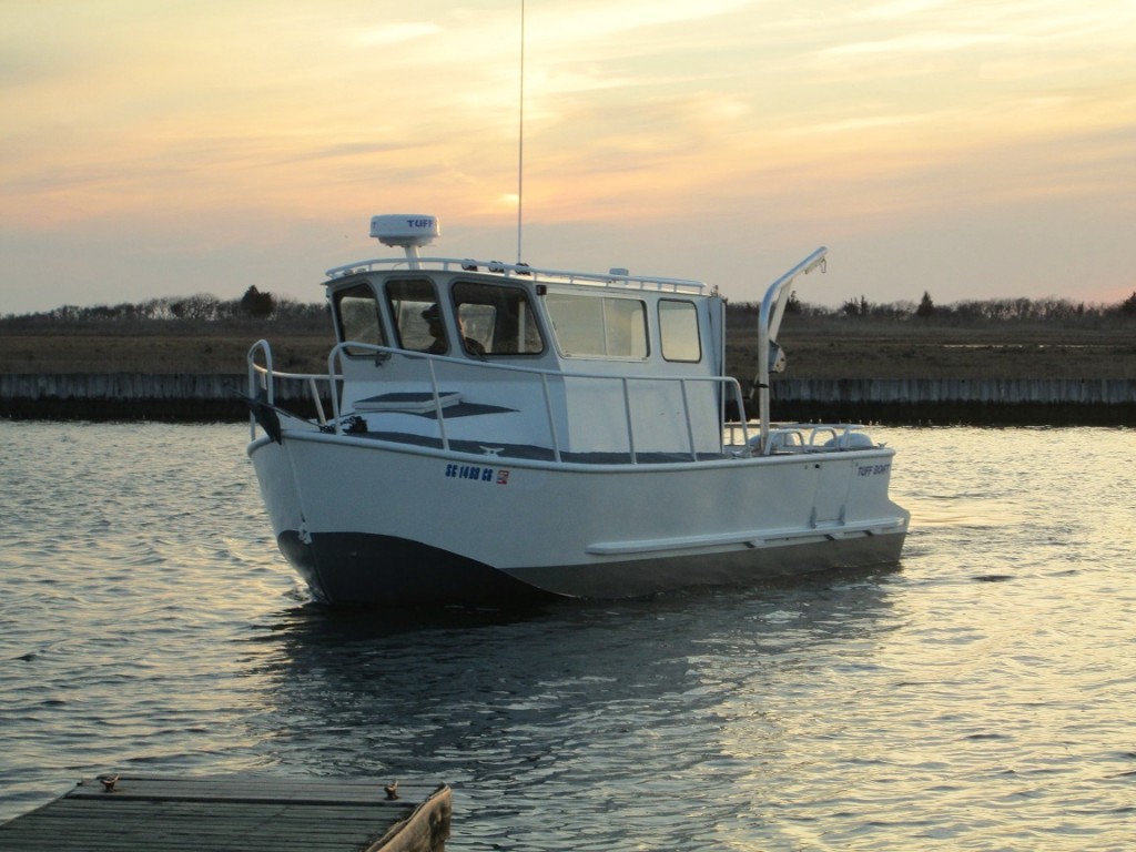
CSE’s U.S. Coast Guard licensed captain, Drew Giles (50 GRT Master #272015), pilots the RV Southern Echo for offshore data collection. RV Southern Echo is a 24 foot Tuff Boat Great White with a custom welded aluminum hull with twin 90 Honda outboards. A fully enclosed pilot house and spacious working deck allow our crew to survey, deploy gauges, and collect samples in a comfortable and controlled manner.
CSE’s field data collection, equipment, and in-house capabilities focus on three critical aspects of coastal engineering:
- Measurement of coastal processes and sediment transport.
- Measurement of topography and bathymetry.
- Measurement of sediment quality.
Among CSE’s high-end instrumentation are:
- Trimble® Model R10 GNSS RTK receivers
- Applanix POS MV SurfMaster IMU (equipped on RV Southern Echo)
- Odom CV100 Digital Survey Echosounder (equipped on RV Southern Echo)
- RDI acoustic current meter (Workhorse ADCP)
- Sontek acoustic current meters (XR)
- Two CL wave gauges with paros sensors
- Four CL tide gauges with paros sensors
- One CTD profiler
- Odom CV100 real time GPS bathymetry mapping system
- Proprietary coring system operated by divers for borrow area sand searches
In one project, CSE’s in-house staff (including certified diver-engineers) deployed nine instru-ments for 30 days, retrieved them, downloaded the data, and then redeployed them at new locations for another month before retrieving the gauges. Despite zero visibility in the turbid waters of the site, CSE’s technicians were able to recover all gauges, and only 5 percent of the data were lost because of equipment malfunction.
