
Project: Accreted Land Management Plan
Client: Town of Sullivan’s Island (SC)
Key Design Problems Addressed:
- Coastal zone management
- Environmental studies
- Planning studies
- Resource surveys
- Feasibility studies
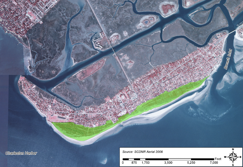
Sullivan’s Island (at the north side of Charleston Harbor), South Carolina, is an ~4-mile-long barrier island that has gained upward of 685 acres of beach by natural accretion over the past 50 years. Much of the oceanfront is 1,500 feet wider than it was at the time of development. Rapid accretion has created unforeseen management problems and opportunities because of the transformation of the accreted land from sparsely-vegetated dunes to early climax forest. The project involved development of a management plan for maintaining aesthetic quality and property values along the oceanfront as well as recommendations for improved storm protection.
CSE, working with subconsultants Sabine & Waters Inc and Dewberry, was retained by the town of Sullivan’s Island to assist in preparing an “accreted land management plan” for the community. The team’s work included detailed field surveys of topography and vegetation zonation, review of the shoreline history and controls on shoreline changes, and modeling of storm-surge impacts under several alternative conditions. The data collection and analyses of historical aerial photographs confirmed rapid succession of vegetation in the accreting lands with little growth of dunes. The resulting transformation from dune grasses to dense shrubs and mature forest had unintended consequences which were highlighted in the plan:
- Vegetation stabilized low dunes before they could gain height and yield better protection during storms. Poor drainage between low dunes created more habitat for mosquitoes.
- Some beachfront property owners, who wanted to maintain views as the accreted land widened, severely pruned vegetation each year to maintain a shrub-dominated landscape, whereas adjacent property owners have allowed natural succession with uneven consequences.
- Excessive accretion, while offering advantages compared with eroding beaches, had a dampening effect on property values and the local tax base.
The CSE team identified several management strategies for the accreted lands. First, the study demonstrated through vegetation surveys that diversity of habitat as well as view corridors could be maintained by strategic pruning and reshaping of the landscape. Wider paths flanked by areas dominated by native grasses would open view corridors, while hammocks of shrubs and climax forest vegetation would provide the full spectrum and diversity of barrier-island habitats. The team demonstrated that minor reshaping of small portions of the landscape could create protective dunes as well as open-water ponds thereby increasing habitat diversity.
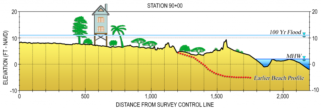
Model studies showed that property damages in storms could be lowered significantly through dune enlargement compared with damages associated with existing topography and mature shrub or forest vegetation. The study demonstrated that the underlying process accounting for excessive accretion along the island was natural bypassing at the upcoast inlet and a plentiful sand supply from the adjacent island. The team developed a sediment budget to illustrate likely future trends for the island. Storm-surge modeling simulations showed that addition of a single, low-dune ridge ~4 feet higher than existing topography would reduce potential flood damages to oceanfront property by 50 percent compared with existing conditions. Larger dunes, of course, would potentially be even more effective should the community elect to proceed with the team’s recommendations.
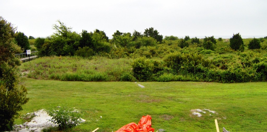
Typical view from a “beachfront” house ~1,500 ft from the ocean.
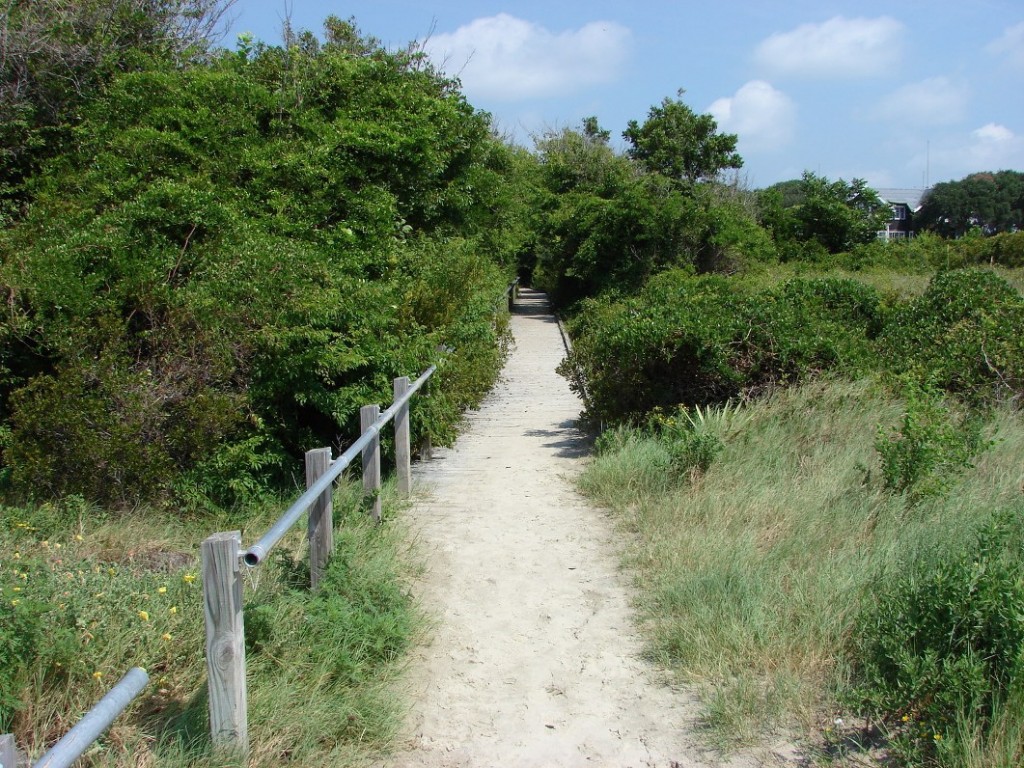
Beach access path at Sullivan’s Island, SC.
Sullivan’s Island, SC
Natural accretion at Sullivan’s Island has moved the shoreline over 1,000 ft seaward in the past 50 years.
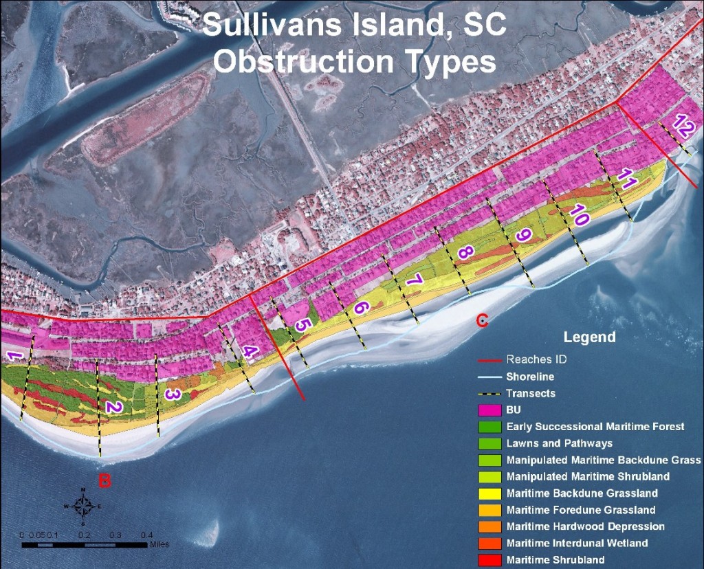
Habitat distribution map. Homes are in the “BU” zone. Sandbars migrating shoreward from the updrift inlet account for decades of beach growth along most of the island.
, Beach Nourishment")


