Hurricane MATTHEW is on track to create a major wave event along the South Carolina coast. And that will be bad news for the oceanfront.
The storm surge will be much lower than HUGO’s in 1989 because MATTHEW will track parallel to shore rather than coming straight in from the ocean. It will initially produce onshore winds as it moves northeast. Then winds will back around and come from the west as the storm center passes each coastal town. This will play out on Saturday, October 8th as the hurricane moves from Savannah to points north.
As the storm enters South Carolina waters, wave heights close to shore are likely to exceed 16 feet according to the latest NOAA models. This will be the energy that cuts back the beach, washes out dunes and initiates damage to houses that are too close to the high tide line.
Yes, we’ve seen this before, but here’s what will be different.
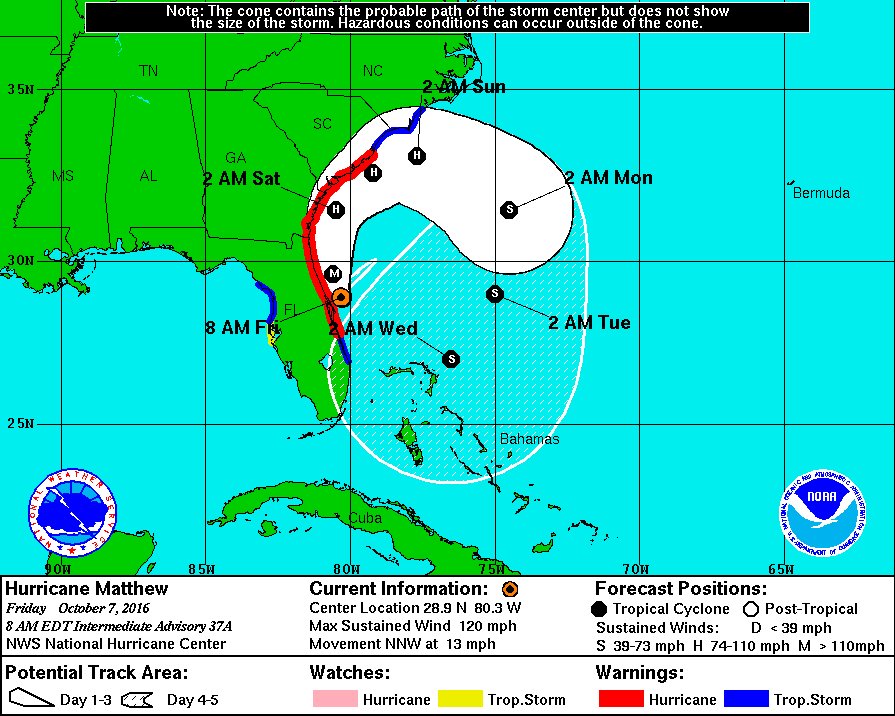
MATTHEW is expected to loop slowly around to the southeast and still be just off the SC coast on Monday. The projected track means winds will keep pumping energy into waves, making them larger, and driving them directly onshore for days. Models are predicting 8-10 feet waves close to shore Sunday through Tuesday. Therein lies the problem.
Our beaches will have to absorb more big waves than would be typical during most hurricanes. These waves will be much higher than the ones we experience during northeasters that linger for days. We’ve seen winter storms – northeasters- cut the beach back by 40 feet. HUGO cut the dunes back over 80 feet at Litchfield Beach well north of its storm center. The models suggest MATTHEW will do even worse.
As things stand now, South Carolina will have to get through at least five or six high tide periods of big waves. The first or second high tide early Saturday afternoon will reshape the beach, but the successive high tides are likely to produce major structural damage. By then, the waves will be breaking directly on houses that lost their dune protection in the preceding tide. A minor consolation is the fact that predicted tides through Tuesday are at least 1 foot lower than the highest tides of the month. But the hurricane’s low pressure will offset that advantage and lift water levels higher even with its center poised offshore. In short, we’ll have the equivalent of king tides for days.
From all accounts this will be an extreme event. The waves will swash up and over the dunes carrying sand under houses and on to roads. The post-storm beach will appear to be wider and flatter than many people have ever seen. Houses that were safely behind dunes on Saturday will find themselves perched on the active beach by Tuesday, if they are still standing.
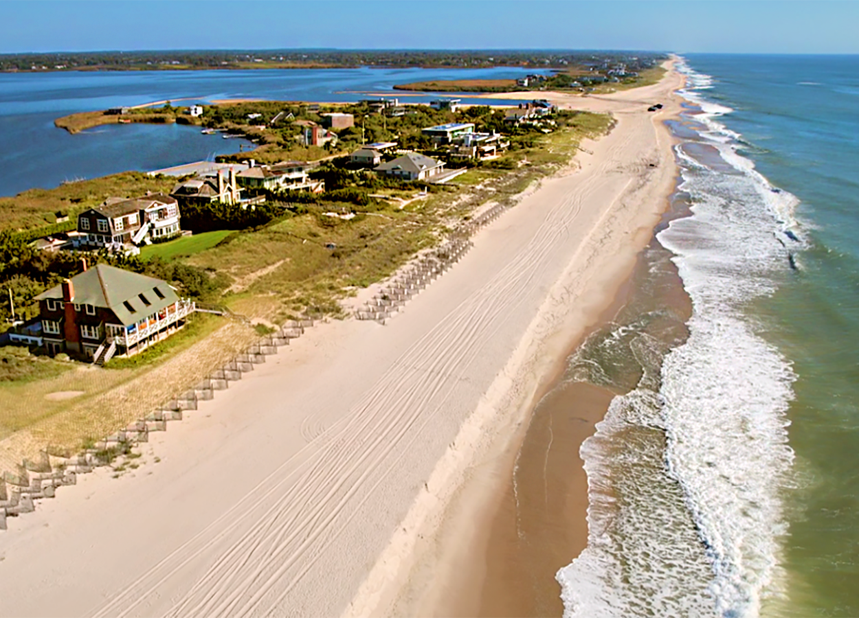
The most vulnerable beachfronts will be places where houses are less than 100 feet from the dry sand beach. This includes much of Edisto Beach, Folly Beach, Pawleys Island and Garden City.
Seawalls that have been buried for years will be re-exposed. In many cases, these structures will reduce damages, but they will not protect all properties as we’ve seen in other storms.
In the aftermath, here are some things, the state, municipalities and property owners should anticipate doing once power is restored and communities assess their damages:
- Clear roads of sand and remove debris
- Push up an emergency dune along vulnerable properties
- Mobilize equipment to sift debris from sand and place the sand back on the beach.
- Install sand fencing and dune plantings to jump start regrowth of dunes
Beaches are quite resilient and bounce back in a few years after major storms. This won’t happen quickly, but it should be a prime consolation as we look forward to next summer at the beach.
Each hurricane has its own behavior and it is never smart to trust anyone to predict the precise impacts and outcome. But in the case of MATTHEW, South Carolinians should assume that the storm will still be damaging our oceanfront through October 11th –next Tuesday. I would like nothing better than to be wrong about this.
Tim Kana
6 October 2016
Dr. Kana is president of Coastal Science & Engineering Inc based in Columbia. He served as special advisor to the Governor’s Office during the response to Hurricane HUGO.